Talks on river corridors could inform future bylaws in Bernardston
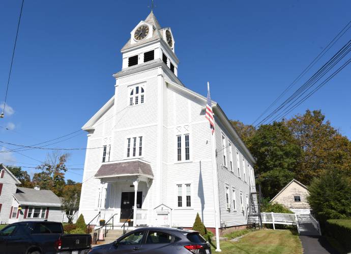
Bernardston Town Hall. Staff File Photo/Paul Franz
|
Published: 08-12-2024 3:25 PM
Modified: 08-14-2024 5:25 PM |
BERNARDSTON — Town officials discussed areas of Bernardston that are most susceptible to flood damage during a presentation on the town’s six river corridors last week that could inform future discussions on bylaws regulating infrastructure in those areas.
Planning Board alternate member John Lepore, certified restoration ecological practitioner with Future Lands Designs LLC, shared information on river corridors. According to a Franklin Regional Council of Governments (FRCOG) webpage on the subject, a river corridor consists of the water from a river, its banks and the land nearby. Areas in a river corridor are susceptible to becoming part of the river based on changes in the flow of the water.
While Bernardston’s bylaws don’t specifically refer to river corridors, a special permit from the Planning Board is required for “all proposed construction or other development in the Floodplain Overlay District, including new construction or changes to existing buildings, placement of manufactured homes, placement of agricultural facilities, fences, sheds, storage facilities or drilling, mining, paving and any other development that might increase flooding or adversely impact flood risks to other properties.” Compliance with wetlands laws is also required.
Lepore presented images from Vermont towns like Plainfield that recently experienced flooding due in part to river corridor changes. These changes are from riverbank erosion and deposition, and Lepore stressed that buildings and structures within a river corridor are at an increased risk of flooding from both natural and man-made causes of erosion and deposition.
Climate and vegetation changes, watershed size and shape, geology of a river and connecting streams to the river are listed as natural factors impacting corridors.
Man-made causes like infrastructure developments within floodplains can also impact the river corridor, which in turn creates a risk for homeowners and those who own property in the corridor.
Bernardston has six river corridors: Keets Brook, Fall River North, Dry Brook, Fox Brook and Fall River South, Mill Brook and Couch Brook. There are houses and other buildings located in each of these river corridors.
Although no votes were taken on the subject, the Selectboard hosted the presentation to hear information that could inform bylaws regulating infrastructure located within the river corridors.
Article continues after...
Yesterday's Most Read Articles
 Local ‘Hands Off!’ standouts planned as part of national effort
 Incandescent Brewing now open in Bernardston
 Two arrested on drug trafficking charges in Greenfield
 Berkshire DA says no crime occurred in student-officer relationship at Mohawk Trail
 Proposed ordinance would make Greenfield a ‘sanctuary city’ for trans, gender-diverse people
 Sounds Local: A legend pays tribute to an icon: Seven-time Grammy-nominated Joan Osborne brings Bob Dylan repertoire to Shea Theater
“We’re really lucky to have John,” Selectboard Chair Ken Bordewieck said at the end of the presentation. “There’s not a lot of people with the expertise that John has, but we’re thinking that maybe some sort of a bylaw going forward would be the best thing for us.”
FRCOG Senior Land Use and Natural Resources Planner Allison Gage attended the meeting to offer more information on the role FRCOG played in the development of the river corridor maps. Lepore said he developed a model similar to FRCOG’s River Corridor Toolkit using open-source GIS software.
“The River Corridor Toolkit is something that FRCOG worked on years ago, and the town of Conway has been working for the past four years to adopt the South River corridor as an overlay district,” Gage told the board.
The FRCOG River Corridor Toolkit was developed using funding from a 2017 Massachusetts Department of Environmental Protection grant. Nicolas Miller of Field Geology Services contracted with FRCOG to create the toolkit, which can be used to help municipalities develop bylaws around river corridors.
Gage mentioned some of the options that exist for towns to classify river corridors and work with developers and homeowners on development plans in those parts of town.
“Most uses in the river corridor would require a special permit, so they’re not necessarily outright prohibiting it, but it would require a conversation with the developer to see what would make the most sense,” Gage said of the special permit method used by some towns. Others, she added, create overlay zoning districts for river corridors. “Doing an overlay district would probably be the most restrictive method.”
Erin-Leigh Hoffman can be reached at ehoffman@recorder.com or 413-930-4231.
An earlier version of this article provided an incorrect title for John Lepore, who is a certified restoration ecological practitioner. Additionally, Nicolas Miller of Field Geology Services contracted with FRCOG to create the River Corridor Toolkit. Lepore developed a model similar to FRCOG’s toolkit using open-source GIS software.


 New panel to review senior housing proposals in Deerfield
 Shutesbury reviewing how to improve safety on Lake Wyola in wake of accident last summer
 Local libraries react to state funding cuts, federal administrative leave
 Colrain zoning board approves variance for Call Road cell tower
